After Arnab, a new depression is forecast to head for Andhra, with very heavy rain on 2-3 November
IMD says a low over the Andaman Sea is likely to become a depression around Saturday and move towards the Andhra Pradesh coast. Fishermen have been told not to venture out.
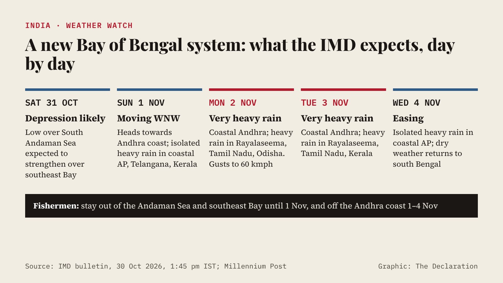
A new weather system is forming in the Bay of Bengal days after Cyclone Arnab battered Odisha and Andhra Pradesh. The India Meteorological Department (IMD) said on Friday that a low-pressure area over the South Andaman Sea is very likely to strengthen into a depression over the southeast Bay of Bengal around Saturday, 31 October, and then move west-northwest towards the Andhra Pradesh coast over the following two days.
The IMD has forecast isolated heavy to very heavy rainfall over coastal Andhra Pradesh on 2 and 3 November. It has not said whether the system will strengthen into a cyclone or given a landfall point; Outlook reported that some forecast models point towards north Tamil Nadu and south Andhra Pradesh.
Where and when rain is expected
According to the IMD bulletin issued at 1:45 pm IST on Friday:
Coastal Andhra Pradesh and Yanam can expect fairly widespread to widespread rain on 2 and 3 November, with isolated very heavy falls on those days and isolated heavy rain on 1 and 4 November. Thunderstorms with gusty winds of 40-50 kmph, gusting to 60 kmph, are likely on 2 and 3 November.
Rayalaseema and Telangana are likely to see isolated heavy rain on 1-3 November. Tamil Nadu, Puducherry and Karaikal may get isolated heavy rain on 2 and 3 November, and Kerala on 1-3 November. Odisha, still recovering from Arnab's floods, can expect fairly widespread rain on 1 November and isolated heavy rain on 2 November.
The Deccan Chronicle, citing the IMD in Visakhapatnam, listed Vizianagaram, Visakhapatnam, Anakapalle, Alluri Sitharama Raju, Kakinada, Konaseema, East and West Godavari, Eluru and Krishna among the districts likely to get heavy rain.
Warnings for fishermen
Fishermen have been advised not to venture into the Andaman Sea and parts of the east-central and southeast Bay of Bengal until 1 November, and along and off the Andhra Pradesh coast during 1-4 November. The IMD warned of possible damage to kutcha houses and trees, local flooding, landslides in hilly areas, and disruption to road, rail and helicopter services, and advised people in the affected areas to regulate tourism and outdoor activity.
No port warning had been issued in Friday's coastal bulletin, according to PTI, as reported by Outlook.
What is left of Arnab
Arnab, which crossed the Andhra Pradesh coast earlier this week, has weakened into a low-pressure area over north Chhattisgarh and neighbouring east Madhya Pradesh, the IMD said on Friday. In the 24 hours to 8:30 am on Friday, Kusmi in Chhattisgarh recorded 28 cm of rain and Bhograi in Odisha 19 cm.
In West Bengal, the remnant brought up to 90 mm of rain at Amgachia in East Midnapore and 80 mm at Digha, Millennium Post reported. Light to moderate rain is expected in Kolkata and parts of south Bengal on Saturday, and the IMD said it had issued no warning for Bengal in connection with the new system. Dry weather is expected to return to south Bengal from 4 November.
What happens next
The IMD issues updated bulletins several times a day, and its next forecasts will show whether the depression strengthens further as it moves over the Bay. State governments had not announced specific preparations for the new system by Saturday morning.
Sources
- India Meteorological Department: Press release, 30 October 2026, 1345 hours IST
- Outlook: Low-pressure area over Andaman Sea likely to become depression, move towards Andhra Pradesh coast
- Deccan Chronicle: Fresh low pressure area over Bay, more rains for AP
- Millennium Post: Arnab's remnants weaken further
This story was researched and drafted with AI assistance and reviewed by an editor before publication. Spotted an error? Tell us. Corrections log.